PADUCAH, Kent. — A National Weather Service survey team out of the Paducah NWS has released is preliminary findings concerning the tornado that struck Perryville Friday night.
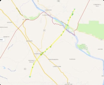
The tornado is being listed as producing high-end EF-2 damage in Perryville.
The track extends southwest to northeast through the county and also extends into Randolph County, Illinois.
The survey team is unsure at this time if the track started further southwest back in Bollinger County.
For now the tornado had maximum winds of 135 miles an hour and a track length of 25 miles.
This data is preliminary and is subject to change.